72nd and Colorado Station Area

Introduction
In 2004, voters approved the Regional Transportation District’s (RTD) FasTracks Program, a multibillion-dollar comprehensive public transportation expansion plan consisting of new commuter rail, light rail, and express bus services.
In November 2013, RTD selected a team for the design and construction of the entire North Metro Corridor commuter rail line which includes the E. 72nd Avenue Commuter Rail Station in Commerce City. Neighborhood improvements around completed FasTracks rail stations in other communities are beginning to take shape with new development, diversified housing, infrastructure improvements, and neighborhood amenities.
The arrival of Commerce City’s commuter rail station brings well-deserved and critically needed focus to the neighborhoods surrounding the Commerce City 72nd Station.
STAMP
 In 2013, the City of Commerce City adopted the Station Area Master Plan (STAMP) developed through the culmination of efforts by a wide range of community stakeholders to identify improvements to existing neighborhoods, leverage the area’s assets and opportunities, and envision a preferred future for the area.
The STAMP explores transit-oriented and transit adjacent development—one that emphasizes strengthening existing residential neighborhoods and corridors while allowing opportunities for new development. The end result has the potential to enhance connectivity and transit use; strengthen existing building stock; boost economic development opportunities; attract diversified housing, employment and neighborhood-serving uses; and contribute to a strong sense of place for both existing and future residents and business owners.
Where We Are
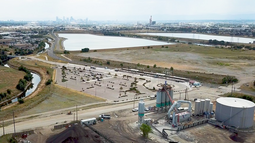
In 2020, construction of the E. 72nd Avenue Commuter Rail Station was completed and opened to the public. This is the first commuter rail line to pass through Commerce City and the first station to be established within the city are limited.
The station is in an area with an existing neighborhood that is a patchwork of city parcels and pockets of unincorporated Adams County with low-density single-family homes, schools, and civic buildings next to industrial uses. Within this patchwork, there is currently a lack of “destination” places in the project area. Previously, Adams City High School and Alsup Elementary School served as anchors of the neighborhood, but they have since relocated.
The vision for this station area is one of pedestrian, bike, and automobile connectivity with diverse housing stock, economic development opportunities, employment, recreational amenities, and neighborhood-serving uses. It will take critical thinking and innovative infill to achieve the goal of a vibrant Transit Oriented Development and community center.
72nd & Colorado Blvd. Conditions Report(PDF, 14MB)
Action Steps - Funding Options
The most feasible option to lead the revitalization efforts and finance public improvements is to establish an Urban Renewal District and utilize Tax Increment Finance (TIF). Local input from area property owners, businesses, and residents is critical to an effective process. Once established, the district would receive a portion of the incremental tax revenue associated with new development. The district can use this revenue to fund area-wide improvements (such as streetscape or pedestrian linkages), or may choose to partner with a developer and invest the proceeds back into the development in order to make the project feasible.
This chart illustrates how assessed property value (AV) changes over time within a Tax Increment Financing (TIF) project area. The x-axis represents time, beginning at project creation and ending at termination (spanning 0 to 20+ years). The y-axis represents the assessed value of assets.
- The blue section labeled “Based Asset Value” shows the original taxable value, which belongs to all other assets in the project area throughout the project duration.
- The brown triangular section labeled “Incremental Asset Value” reflects the increase in property value generated by the development. This increment is allocated to the TIF authority to cover project costs.
- At the end of the project, the green section labeled “New Post-Project Asset Value” represents the full assessed value after project completion. At this point, all value returns to the broader asset pool in the project area.
The diagonal line labeled “Increased AV from Development” indicates the growth in value due to development over time.

Este gráfico ilustra cómo cambia el valor evaluado (AV) de una propiedad a lo largo del tiempo en un área de proyecto de Financiamiento por Incremento de Impuestos (TIF). El eje horizontal representa el tiempo, desde la creación hasta la finalización del proyecto (de 0 a más de 20 años). El eje vertical muestra el valor evaluado de la propiedad.
- La sección azul, marcada como “Valor de Activo Base”, representa el valor imponible original, que pertenece a todos los demás activos del área del proyecto durante toda su duración.
- La sección triangular marrón, “Valor de Activo Incremental”, muestra el aumento en el valor de la propiedad generado por el desarrollo. Este incremento es asignado a la autoridad TIF para financiar los costos del proyecto.
- Al finalizar el proyecto, la sección verde, “Nuevo Valor de Activo Después del Proyecto”, representa el valor total evaluado después del desarrollo. En ese momento, todo el valor vuelve a ser parte de los activos generales del área.
La línea diagonal marcada como “Incremento de AV por Desarrollo” indica el crecimiento del valor a lo largo del tiempo debido al proyecto.